Directions to Bethlehem Cemetery (Boligee)
      				Greene  County, Alabama                       
      				
  
				 | 


				| 
      				Cemetery Address | 
      			
      				Off CR 148 
      				Boligee, Alabama                        
      				 
				 | 				


				| 
      				Latitude | 
      			
      				32.7292991     
      			 | 
      		
            
				| 
      				Longitude
      			 | 
      			
      				-87.9555715    
      				
  
				 | 				


				| 
      				Township/Range/Section 
      			 | 
      			
      				T20N R1E  S11
      				
  
				 | 				


				| 
      				Directions to Cemetery | 
      			
      				US 43 (Demopolis Rd) south of Eutaw to west on CR 148 about 2.9 miles. South on unnamed road about 2/3 mile. The unnamed road is almost one mile west of CR 142.
      				
  
      			 | 				


				| 
      				Historic Map Reference
      			 | 
      			
      				Historical Atlas of Alabama, Volume 2, Map 139 
                    -SE 
      				
  
      			 | 				


				| 
					   
      			 | 


				| 
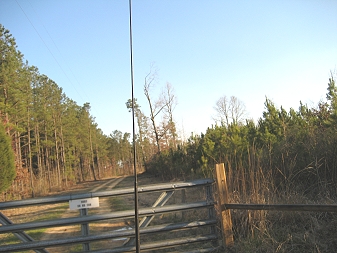
					 Bethlehem Cemetery (Boligee) locked gate 
					Page 2 
      			 |