Directions to Zion Hill Missionary Baptist Church Cemetery
Greene County, Alabama
|
|
Cemetery Address |
County Road 156
Jena, Alabama
|
|
Latitude |
33.1181777
|
|
Longitude
|
-87.881405
|
|
Township/Range/Section
|
T22S R13W S22
|
|
Directions to Cemetery |
Co Hwy 2 (156) about 1 mile west of County Road 191, between Union and Gordo. Go south on unnamed road 1/4 mile. About two miles west of Shiloh road in Jena. Just south of the Sipsey River.
|
|
Historic Map Reference
|
Historical Atlas of Alabama, Volume 2, Map 9
-NE
|
|
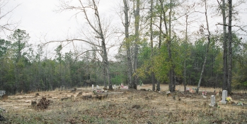
Cemetery Notes
|
This cemetery is also known as Mount Zion
|
|
|
|
Zion Hill Missionary Baptist Church Cemetery
Page 2
|