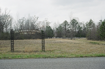
Directions to Pleasant Grove (near Jena)
      				Greene  County, Alabama                       
      				
  
				 | 


				| 
      				Cemetery Address | 
      			
      				Co Hwy 2 
      				Jena, Alabama                        
      				 
				 | 				


				| 
      				Latitude | 
      			
      				33.13099       
      			 | 
      		
            
				| 
      				Longitude
      			 | 
      			
      				 -87.84754     
      				
  
				 | 				


				| 
      				Township/Range/Section 
      			 | 
      			
      				T22S R13W  S13
      				
  
				 | 				


				| 
      				Directions to Cemetery | 
      			
      				At intersection of Shiloh Road (62/67) and Romulus Road (62/67) in Jena
      				
  
      			 | 				


				| 
      				Historic Map Reference
      			 | 
      			
      				Historical Atlas of Alabama, Volume 2, Map 10 
                    -NE 
      				
  
      			 | 				


				| 
      				Cemetery Notes 
      			 | 
      			
      				This cemetery is also known as Pleasant Grove Methodist Church Cemetery
      				
  
      			 | 				


				| 
					   
      			 | 


				| 
					 Pleasant Grove (near Jena) 
					Page 2 
      			 |